Gale!

We thought we were so tough, having survived wild episodes in remote parts of the world, such as the unpopulated sections of western panama, the lawless portions of eastern Nicaragua and Honduras, the whole of California, etc. In those, places we’d often be the only boat in an anchorage, relying on our own gear and wits for survival. Weather prediction would be a hazarded guess, at best. So we naturally thought that our sojourn to the Bahamas, basically in Florida’s backyard and populated by thousands of like-minded cruisers, would be a walk in the park, literally. But nothing prepared us for the once-in-a-generation freak storm we endured on January 6, 2016. Winters in the Bahamas can be tricky at times because cold fronts come off the eastern US and pass through and can bring winds that change directions and strength, along with rain and thunder on occasion. On this occasion we knew that a front was passing through, but it was not predicted to be very windy in our immediate area.

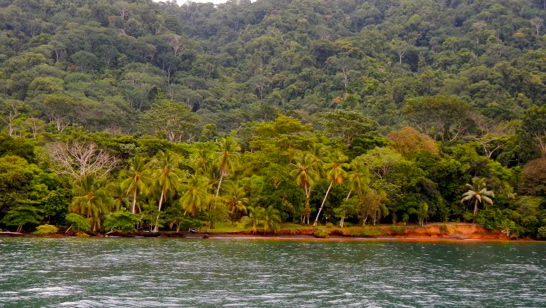
Wrong! We were taking it easy the day after a night of 30 – 40 knot easterly winds – these are strong winds, but are common in the Bahamas. They come from the East and there are many islands to hide behind to avoid the waves that such winds can generate. We usually don’t mind the wind alone because it is the waves that really move the boat around. That night was windy but not anything we were not used to. The next night was predicted to have lighter wind from the West. There are fewer places to hide from West winds in the Bahamas and we went to a location that was good for us in the recent past – just behind the large rock called Thunderball Grotto, where they filmed part of the James Bond film Thunderball (it has a really cool interior cave, which will be highlighted in the next blog post). These rocks have a small area to the East of them where you are sheltered from West winds. So we settled in thinking no big deal because winds were not predicted to be strong and in any event we had good old 007 rock to break the waves.

DSC_1344

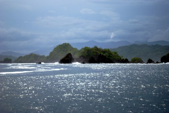
Our hidey spot behind Thunderball Rock, in less crowded times

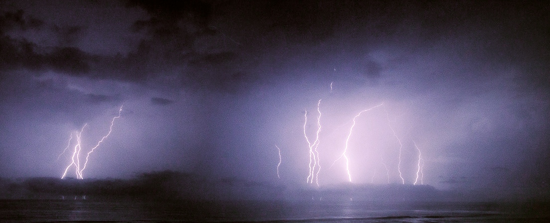
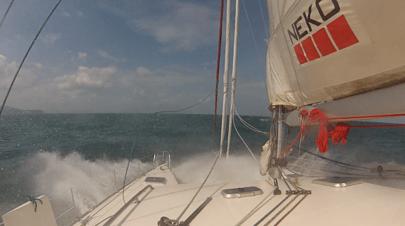
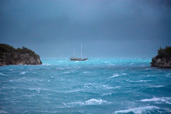
Around 6 pm we noticed the wind beginning to pick up – a normal circumstance toward the evenings here. However, it did not die down and continued to build, and rapidly. The wind quickly accelerated to 30+ knots, and then it jumped above 40 knots and stayed there. Things were getting hairy. There were 3-foot waves in the anchorage even though they only had 200 feet to develop. Whitecaps in a swimming pool it seemed like – and then they started getting blown off and the waters were white with foam and the winds were roaring.

DSC_1354

It never looks as bad in photos as it really is, and this looks bad.  This was when it first started; the worst of it was in the dark.

DSC_1352

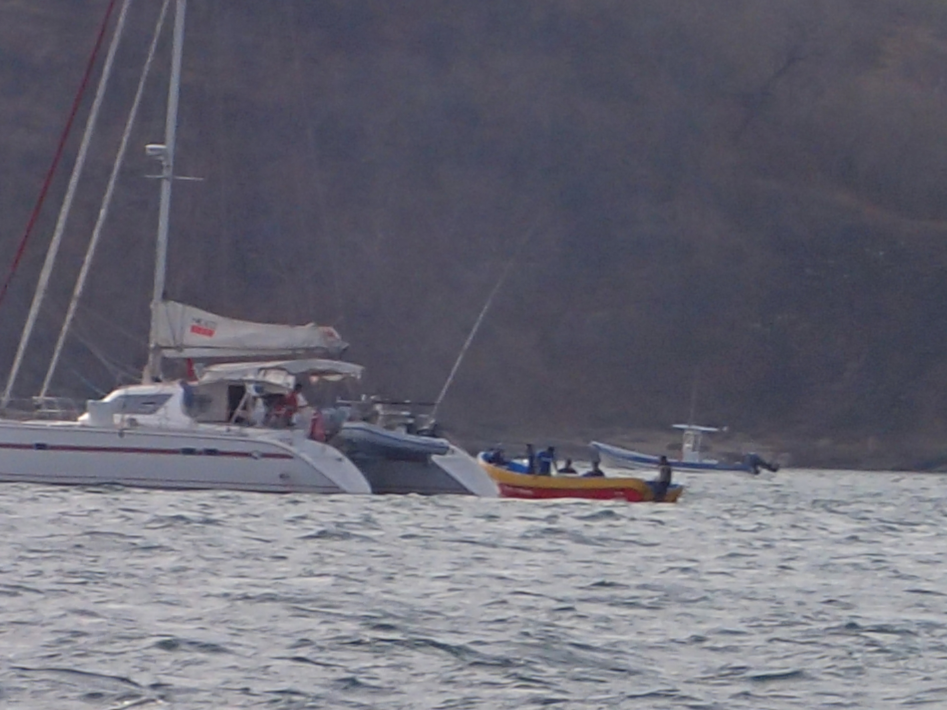
One of the cats that dragged past us.

Then the wind increased above 50 knots and again stayed there, and we were closing in on hurricane territory.

IMG_9419

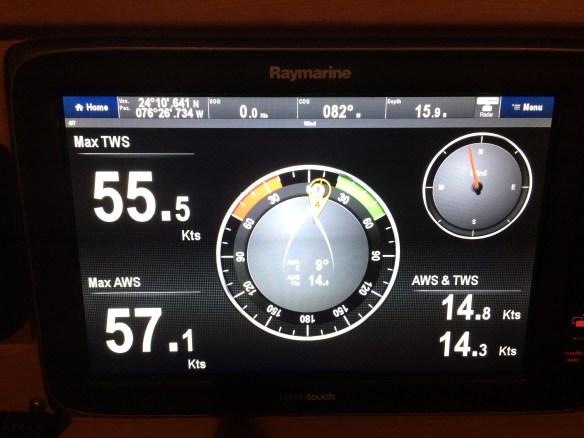
Instruments recorded max wind speed at 55.5kts (63mph)

Things were getting really dicey at this point. I started the engines to push the boat forward to take some strain off the anchor – after all, it was the only thing holding us from a wall of rocks ¼ mile behind us. In these sorts of winds, anchors can give up their hold and let boats go sliding off into oblivion. And it was no different this night. We saw one catamaran go sliding past us, and there was nothing we could do to help him. We just hoped his anchor dragging along the bottom didn’t snag ours and send us on our way too. I was driving the boat to move it out of the way of the dragging boat and take the strain off the anchor.

DSC_1356

Two young guys on this boat out in the open were dragging anchor.  They started the night in front of the rock to the right.  We were glad to see the next day that they stopped short of the rocks.

The rain was coming down so hard that I had to wear sunglasses – I couldn’t open my eyes otherwise. Then another catamaran went by – so eerie and sad to see that in the dark, knowing that those people were in for a world of hurt and you can’t do anything about it. This went on for about 2 hours, with me driving the boat – each time it got a bit sideways, the wind would grab it and I could feel it accelerate out of control sideways. It was lifting our big boat up and tilting it a bit on its side, with spray flying over the side. I gave the engines full throttle just to stand still and try to correct our angle so we wouldn’t slide off into oblivion as well. Mary kept a watch for other boats heading our way in the dark.  She handled the radio, which crackled with maydays and frenzied shouts for help or warnings about impending collisions and was running around giving me clothes to protect from the freezing rain – I started the ordeal in just swim trunks and ended up in full foul weather gear with sweatshirts and boots underneath .  At one point, I looked back and saw that our dinghy, which was hanging behind our boat on a rope, had turned upside down, flipped by the wind like a child’s toy. To add salt to the wound, a stray line from the overturned dinghy caught our starboard prop, killing that engine. I stripped the foul weather gear, dove in and removed the line. Luckily it was not wedged round tightly and I remember that the water felt lovely and warm. I just wanted to stay there and forget about the maelstrom above. But I jumped out, quickly showered, put the foulies back on and went back to the helm.


Finally, the winds subsided. I never thought of 30 knots of wind as “light” but it felt that way this night. All the boats were haphazardly strewn about the anchorage. One boat with a French couple and their dog were blown ashore and crashed into someone’s docks, tearing them up.  Another boat washed up against the rocks and started breaking up and taking on water. I was impressed with how calm the guy sounded in putting out his mayday – he was more sad than panicked.  One of the catamarans that slid past us ended up on the rocks with a hole in a bow, a rudder broken off and many other issues. This is the end of the cruise for some of these poor folks. Exhausted, but with hearts still pounding we tried to get some rest but continued to keep a watch throughout the night. When we heard our errant dinghy under the boat and scraping its propeller against the hulls, we went outside at 3 am and flipped it over. Easier than it sounds for 350 pounds of sodden rubber boat in a raging sea. But somehow we did it and tied it up. Next we saw that some of the boats that moved were very close to us. We would have started banging into each other if no one did anything. Now, generally when anchoring space gets too tight it’s up to the latest arrival to move. And the draggers who ended up very near us should have upped anchor to relocate to a safer place. But it became apparent to us that people were too shell shocked to take the proper action. So in the dark of night (by the way, this had to happen on a moonless night) at 4 am we fired up the engines to find a place to anchor safely away from anyone banging into us.  This accomplished, we collapsed into the bed. Surprisingly, adrenalin would not let us sleep and Mary was up at 6 am like she is every day. Its funny how bodies work that way, but the smell of coffee made its way down and I was not far behind her.

We spent the next day cleaning up and trying to save the engine of our dinghy.  An episode like this really lets you know who your friends are and can bring out the best in some. Our long time buddy-boaters, Charlotte and James, on their way to Nassau to effect their own repairs, offered to bring back a new outboard engine for us and to anchor near us and shuttle us around since we now have no way to get to shore to get provisions.

IMG_9430

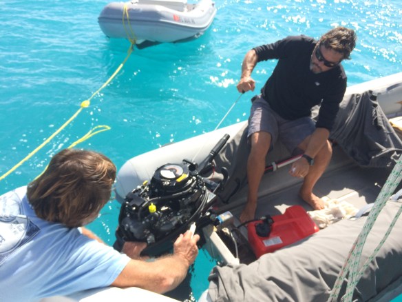
Bob and I trying to get the waterlogged engine going.

Bob on another boat in the anchorage spent several fruitless hours with me trying to get our engine running again. After we put out a call on the radio for the stuff that fell to the bottom from our dinghy (the water is crystal clear here after all), we saw several boats trolling around looking for it. And we tried to do our part by giving parts to other boaters who needed them.
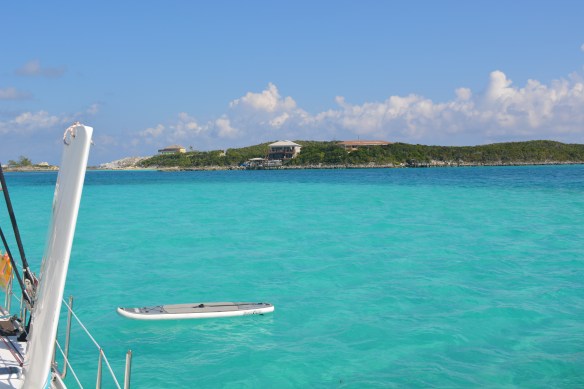
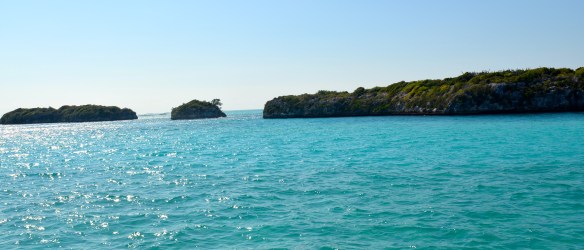
 

DSC_1345

The calm

It was sunny and calm now and you wouldn’t know that such danger was only 12 hours past. Some say that traveling like we do is hours of boredom punctuated by moments of sheer terror, and this was one night to prove it. We are glad we are safe and only have a waterlogged outboard motor to deal with. We are also glad that the people on those boats that went ashore are all OK. We were impressed by and proud of the way the community rallied to help others in distress.  Some people showed amazing bravery in heading out at the height of the storm to try to get to those calling for help.   Its just part of what we chose to deal with when we embarked on this crazy lifestyle, but we sincerely hope not to endure anything like that again.

This video shows the start of the storm.  When it got worse, Mary had to put down the camera.


Cape Crusaders

Whew, what a ride. We wanted to make up for time lost in Fort Lauderdale and get to our old northern stomping grounds. So we screamed up the coast from South Florida to Orient NY in 3 weeks.   Along the way we dealt with some of the gnarliest capes that the US east coast has to offer.   Although we were really moving, we enjoyed our time in Charleston. However, it ended all too soon and we were then on a 200 mile jaunt up to Cape Lookout. Lookout is a special place with a big circular bay nearly bereft of development.

DSC_0208

Cape Lookout lighthouse

Pete kiting Cape Lookout

Pete kiting Cape Lookout

Pete kiting Cape Lookout cu

It’s a great place for kitesurfing (only wish we could have stayed longer).  We also were able to swim in the water again (a little creepy because of all the shark attacks in the area) and we and R&R Kedger trekked out to spy on the wild horses living on Shackleford Banks. Cape Lookout is a wild and beautiful place, and we hope to return someday.

Our first sighting of the wild horses off in the distance.

Our first sighting of the wild horses off in the distance.

horse #5

orange wildflowers

orange wildflowers

Mary spotting the horses

Mary spotting the horses.

they don't seem to mind if you don't get too close

They don’t seem to mind if you don’t get too close.

Pete and Lucy scout for horses

Pete and Lucy scout for horses

wild ponies sauntering across the dunes

wild ponies sauntering across the dunes

But we had a schedule to keep so we shot over to nearby Beaufort for one night to fuel up and hit the road the next morning.   From what little we saw of Beaufort, we liked it. It’s a cute little old town making a living like so many places off the tourist dollar. It has a lot going for it with its preserved houses and beautiful nature just out the door.

Beaufort, that's bow-fort

Beaufort, that’s bow-fort

They know how to grow a delicious shrimp in the Carolinas.

They know how to grow a delicious shrimp in the Carolinas.

We had a decent weather window and would not have a good one again for a while. So we were presented with the choice of staying in Beaufort/Lookout for about a week to wait for the next window or moving out. With NY calling, we headed out into some of the worst seas we have ever been in. Lucky for us it was just the ocean swell built up from a week of 20 knot winds meeting the outgoing tide from Beaufort. It made for steep 10 footers which had Neko pointing at the sky and next at the deep. But once we got about 5 miles out the waves smoothed out a bit and we were able to turn to take them on the quarter. Life got better.

This leg would have us round notorious Cape Hatteras, the graveyard of ships. This is a treacherous cape that sees low pressure systems spinning off the coast as if being hurled out by the weather gods. They meet up with the Gulf Stream, which passes very close to Cape Hatteras, and often combine to create treacherous seas and nasty squalls. It’s not a place to trifle with.   Lucky for us we had a good weather window and saw only brief periods of high winds and the lightning fireworks show stayed mainly inshore. And are we glad it did – at the point of the cape there were continuous lightning strikes onshore that were so visible and lasted so long it seemed like a colossal Frankenstein experiment.

Hatteras lightening show

Hatteras lightning show

Breathing a sigh of relief as we left Hatteras behind, we set our sights on our next cape – Cape May in good old Joisey (leaving aside Cape Henry and Cape Charles, which we just passed in the night).  Pulling into Cape May after 3 days at sea was such a relief.

Cape May New Jersey

Cape May New Jersey

Fishing Boats Cape May

Fishing Boats Cape May

It was interesting to hear the accents on the VHF change from the slow southern drawl of South Carolina to the tighter drawl of North Carolina and Virginia to the oddly specific accent of those hailing from the Philly-Delaware-South Jersey axis. It is a sound I am very familiar with and knew we were back in home waters.

However, it was just a quick stop. We headed out the next day for the 200 mile trip around Montauk Point (well, they could have called it a cape) and on into Orient Harbor for our long awaited arrival back in Orient.

Happy to see the  familiar Montauk lighthouse signaling us home.

Happy to see the familiar Montauk lighthouse signaling us home.

Catching blue fish left and right.

Catching blue fish left and right.

Oh how sweet to again drop anchor in these familiar waters. The last time we did so was on Quint years ago but nothing ever changes in this place and it looks exactly the same. We don’t have a home any more, but this place feels as much like one as anywhere.

Orient's Bug Light

Orient’s Bug Light

OYC sailing lessons

OYC sailing lessons

Anchored in front of our little Yacht Club

We anchored in front of our little yacht club

Our old Island Packet

Our old Island Packet “Quint” moored in Orient Harbor in 2007.

Honduras – Easy Come, Not So Easy Go

Our little fleet of 3 sailboats (Neko, R&R Kedger, Second Wind) and 1 trawler (Pegasus) all departed Providencia for the Bay Islands of Honduras in the dark wee hours of January 13th.

Providencia anchorage

Providencia anchorage

We had one of the best sails of our career going 350 miles over the top of Nicaragua through little-travelled waters rumored to harbor pirates and drug runners.  However, we only saw an occasional fishing boat or distant cargo ship and our little fleet was able to make radio contact with one another at times.  We turned off the engines just outside Providencia and didn’t turn them back on again until we approached Guanaja, Honduras, 2 nights, 3 days later.  We were making over 10 knots during the days and, even though we slowed down to 5 or 6 at night to get safely through the badly-charted, reef-strewn waters, we still had to slow down to a crawl at the end to be sure to make our final arrival in daylight.  We are now in the land of uncharted coral reefs and need sun up in the sky to see and avoid them as we approach land.

20150117_075407_IMG_7656

Neko at anchor. That isn’t another boat in front of us it is a hotel built on a rock.

Guanaja is the furthest east of Honduras’s bay islands.  It is an interesting place where almost all of the population resides on a tiny island in the larger island’s lagoon. IMG_7277 IMG_7278Bonacca town is really two islands long since connected by the construction of buildings, canals, bridges and other things.  It is chock-a-block with small huts and the streets are for walking only.  It has canals cutting through it where locals transport stuff by small boat.

Bonacca canals

Bonacca canals

It can be a little tough – one local told us a way for some to make a little cash is to find floating bales of cocaine and sell them to … someone … for $10,000 a bale.  After questioning a number of locals it turns out this is a new distribution model for drug runners.  Apparently, the USCG patrols the waters of the Bay Islands fairly thoroughly looking for drugs, but not so much the waters closer to Nicaragua that we had just traversed.  There is a fairly steady current running west through those waters along Honduras through the Bay Islands toward Guatemala and Belize.  The drug runners have hit upon the tactic of dumping a lot of bales of coke over in these waters and letting the current take them west.  Locals know that they can find these bales and “sell” them to people who want them.  Surely a number of bales get lost or picked up by authorities, but this method ensures some predictable number get through (as opposed to the cost and disruption of having one large shipment get caught) and entails some cost in buying the bales back from locals (although they are worth a lot more than $10,000, the locals seem to understand they get what they get).  Anyway it was an interesting look at the cat and mouse game being played down here in the illegal drug industry.

Back to Guanaja.  While most of the inhabitants live on this tiny island, the mountainous mainland is sparsely populated.

GuanajaIt has one tiny road and several cars, but the vast majority of people get around by boat.  From sizeable ferries to one-man dugout canoes, there is a bewildering variety of boats plying these waters and rotting in the mangroves ashore.

Local travel

Local travel

These boats have seen better days

These boats have seen better days

One of our favorite stops ashore was Manati, a beautiful restaurant run by German ex-pats.  How odd to find good, solid German food and cold weissbier in tall glasses in such a remote place, but we were hooked.  Manati’s owners, Klaus and Annette, really make you feel welcome.

20150118_172901_IMG_7836 DSC_0049 DSC_0052 DSC_0041

Klaus and Annette, the über friendly owner's of Manati

Annette and Klaus, the über friendly owner’s of Manati

DSC_0025 DSC_0035 Their son, Roland, operates a local B&B but also runs tours on the island.  He took us on a hike to see a waterfall on the sparsely populated windward side.  Guanaja has abundant spring water and this creek and waterfall apparently flow year round.

Our fun loving hiking guide Roland

Our fun loving hiking guide Roland

It was a little more strenuous than we expected.

It was a little more strenuous than we expected.

DCIM120GOPRO DCIM120GOPRO

Lord of the Rings set?

Lord of the Rings set?

Lucy getting a little help from Pete

Lucy getting a little help from Pete

Nice lunch at Green Flash after our hike

Nice lunch at Green Flash after our hike

Worn out from the hike

Worn out from the hike

After about a week, we sailed from Guanaja to Roatan, the largest of Honduras’s islands. Roatan is a much more touristy island. We stayed a week or so at Fantasy Island Marina, where Lucy was constantly harassed by three local monkeys.  We even caught one on our boat one morning and Lucy and I chased it off, barking and yelling.  There were also roosters strutting around, unafraid of the dog, and agoutis, small delicious-looking (at least to a dog) rodents, scampering all over.

This place was too much stimulus for Lucy and we had to get out.  So swapping Mary, who flew out to Utah for Sundance and a stop in Texas, for my brother Chris, we set about leaving Roatan for Belize.

I would miss Mary, but what a treat to have Chris aboard for a while.  He is our first stateside guest since California.  We hope to have many more as we are now in accessible waters with good weather.

Ahoy Chris!

Ahoy Chris!

Checking into and out of countries is often a tiresome exercise in redundant paperwork, cab travel or walking, inscrutable fees, and sometimes mordida (small bribes).  It can be a delightful look into local culture or a ridiculous waste of time.  We were admitted to Honduras in Guanaja with an expired Coast Guard documentation certificate.  This is not a big deal and we had used it in a few other countries.  This certificate is renewed each year and it is sometimes difficult to get it to us on the boat.  Anyway, when we went to check out, the port captain in Roatan, who deals more often with cruise ships than small boats and clearly enjoys exercising his authority, treated us like criminals.  He confiscated our paperwork, told us the boat was impounded and not to move it and demanded a new, original version of the document before he would allow us to leave.  $40 slipped into our passports and put on the table did not move him at all.   When I told him there was no way we could get an original of the document sent to us here in any reasonable time, he said to get a letter from the Coast Guard explaining that a copy would suffice.  When I told him I doubted this could be arranged, he said he had received such letters in the past.  I did not believe him and after I spoke to the Coast Guard the next day it was confirmed as a lie when I was told the Coast Guard do not write such letters.  We were really worried we’d be stuck in Honduras for weeks arranging to get a new certificate mailed to Mary’s folks in the US and then somehow shipped to us here.  We even researched just leaving without exit papers and making the 1100 mile trip directly back to Key West.

Cruisers hangout Roatan

Cruisers hangout Roatan,

However, the U.S. Coast Guard is an efficient outfit and, for a small fee and our statement that we were impounded in Honduras, they expedited the renewal of our certificate.  It actually arrived by email within an hour of my contacting them by phone and submitting the paperwork.  How’s that for a government agency that actually functions!?  I didn’t have my letter but the certificate did have on it a legend stating that it was a certified copy of the original.  Now I just had to convince the little Napolean in the port captain’s office to accept it.  What a relief it was when Chris and I went back and there was a different officer there and he accepted the paperwork without question and processed our departure papers.  We hurried back to cast off the lines and leave ASAP.

adios Honduras

adios Honduras

Dagger To The Heart

You may recall an earlier post where we described a little damage done to one of our daggerboards when we hit a rock in the Las Perlas islands.  Well, thanks to some FORMER friends ;-), we now have a landmark in Panama named after us in perpetuity.

Neko Rock in Eric Bauhaus' "Panama Cruising Guide"

Neko Rock in Eric Bauhaus’ “Panama Cruising Guide”

We attempted to have the daggerboard repaired in Balboa Panama by the local boatworkers.  But they did a poor job and the board did not fit in its trunk very well.  We decided to have Shelter Bay redo the repair, and at the same time perform a few other cosmetic jobs – remove old bootstripes and paint new ones, raise the transoms 3″, repair a few gelcoat dings, etc.

Neko's new stripes

Neko’s new stripes

new swim steps

new swim step

These jobs ended up taking a LONG time.  This is why it seemed we were stuck in Panama forever and why blog posts were few and far between.  We started the work in August and it was not completed until Thanksgiving.  We spent one month in the hotel in Shelter Bay while the boat was out of the water (NB: a lot of cruisers remain living on their boat while it is on the hard, but Shelter Bay keeps the cats far from the showers/heads and it is not easy to lift Lucy up and down several times a day, so we decided to treat ourselves to a hotel – it having air conditioning did not hurt).  When the boat was put back in – splashed in boatspeak – all the work was finished except the daggerboards.  After one more month, the boards were finally ready and we provisioned up and got ready to head back out for more cruising.

Pete leading the dagger lines

Pete leading the dagger lines

Attempt #387 trying to fit dagger boards

Attempt #387 trying to fit dagger boards

However, upon inserting the beautiful new daggerboards back into the boat, they once again were just too thick to slide into their slots.  We were crushed that our job was back to square one. Shelter Bay has a good overall mechanic in Victor, a very good paint/fiberglass guy in Ramon and Edwin, the yard manager, does the best he can with the resources he has.  Diesel work, general rigging, electronic work and sail repairs are done by journeyman sailors who may or may not be there when you arrive.  Also, they may or may not want to or have time to work on your problem.   We got big help from Scott and Eddie (the man) as well and Scott’s dog Eddie, Greg the diesel whisperer, and Pierrick.  The issue with the Shelter Bay yard, however, is that the owners do not provide the resources to function as a proper yard, yet they hold themselves out as being one.

Hard working Scott, Eddie and Peter

Hard working Scott, Eddie and Peter

Scott and Peter make a jig to shape the boards

Scott and Peter make a jig to shape the boards. Eddie the dog supervising.

DSC_0010

Victor is as ready for us to leave as we are

DSC_0007

Ramon, Scott and Pete use the travel lift to hoist the 300lb dagger board

DSC_0003 DSC_0008 DSC_0015 For example, our daggerboard repair took place outside in a work area with a mud floor, an insufficient amount of gravel strewn around to deal with the mud and old planks lying around to walk on.  The area was surrounded by marshy reeds and riven with mosquitoes.  One of the workers flicked a giant spider off him one day and they all worked in fear of snakes every day.  The structure was mere wooden posts with old jibsails tacked to them to attempt to keep dust out, a leaky, rusty corrugated roof that prevented work during rain (do you think it rains in Panama in the rainy season?) and barely adequate electricity.

Scott sanding boards in the mud pit, I mean work shop

Scott sanding boards in the mud pit, I mean work shop

make shift workshop

make shift workshop

Then we moved to an open air area where the ever-present vultures were an ominous metaphor for the entire job.  Once the boards were shaped properly, we moved again to the abandoned theater, er I mean sail loft, to hang for painting.

Not a good omen to see vultures hanging around the boards

Not a good omen to see vultures hanging around the boards

on the move

on the move

Boards hanging to paint

Boards hanging to paint

In any event, after another month of work in these conditions, the daggerboards were finally done.  It was now two days before Thanksgiving and we desperately wanted to have the holiday at anchor in a pretty spot with our friends.  So we ran around frantically for two days cleaning, stowing, provisioning and otherwise getting ready.  We got it done and were finally able to escape Shertel Bay.  Shertel Bay

Life in the Slow Lane

Well, we are overdue for some new content here, but the truth of the matter is that things have just slowed down a bit for us.  It is hurricane season in the Caribbean and, although we are out of the danger zone, it is incredibly rainy, hot and humid.  The weather just makes you lethargic.  We now understand the origin of “island time” and the need for siestas.   You can’t do much or move quickly in these conditions.  Surprisingly, however, it does cool down a bit on most nights and the heat doesn’t build back up until about 7:00am  (LOL, but no joke).  We sometimes take a stroll with Lucy on peaceful mornings. The surroundings are an abandoned US military base that is slowly and silently being reclaimed by the jungle.  It makes for good flora and fauna viewing.  So without further ado, here are some pictures we took on these walks.

Mama and baby sloth -slow lane experts

Mama and baby sloth -slow lane experts

Got a monkey on your back

Got a monkey on your back. White headed Capuchin monkeys

you lookin' at me?

you lookin’ at me?

Welcome to the jungle

Jungle reclaiming Fort Sherman

Is it a loop or a place?

I think every US military base has to have something named Kennedy.

Looks like ruins of an ancient temple.


Kiskadee

Kiskadee. These are all over.

hawk

Hawk

Even the monkeys just lounge about

Even the monkeys just lounge about. Howler monkeys

thorns!

Good deterrent to climbing

Hanging birds' nests

Hanging birds’ nests

Howler walking

Howler monkey on the prowl. Some say they are the loudest land animal in the world.

wild flower

wild flowers abound

DSC_0110

Hanging bird nest

another hanging bird nest

vulture

These look like vultures. They are quite large.

Monkey

More monkey business

Agouti

Agouti – sort of a cross between a wallaby and a rat. Sorry for the blurry photo but he was quick and we barely were able to shoot it.

Apart from the old military base and the jungle, there is nothing around for miles except the remnants of the 17th century Fort San Lorenzo.

DSC_0033_2

Fort San Lorenzo guarded the Chagres River from pirates – and had a good view of it.

Fort San Lorenzo

Fort San Lorenzo


Fort San Lorenzo

Fort San Lorenzo

Manning the ramparts

Manning the ramparts

The old fort had a great view

The old fort had a great view

These cannons are just lying about. Dozens of them.

These cannons are just lying about. Dozens of them.

DSC_0072_2

Sittin’ by the Dock of the Bay…

DSCN3455

Banana Boat

Well, more like the canal.  It is fascinating to be moored here only a football field’s length or so outside the ship channel leading to the canal.  Gigantic ships glide back and forth along it at all hours of the day and night. IMG_0403

Japanese Navy Ship

Japanese Navy Ship

IMG_0418

See how this cargo ship dwarfs Neko (right side of photo)

See how this cargo ship dwarfs Neko (right side of photo, closest boat to cargo ship)

We were pleasantly surprised that they actually throw up very little wake to roll us around.  The work boats on the other hand, are a completely different story.

Go Speed Racer Go

Go Speed Racer Go

Boats come and go allowing us to be neighbors with few interesting boats.

Open 50 raceboat used as a cruiser

Open 50 raceboat used as a cruiser

Falcor-a Gunboat owned by pro snowboarder Travis Rice

Falcor-a Gunboat owned by pro snowboarder Travis Rice

The boats swing according to the current except around slack tide, when the wind dominates.  Since we have a lot of windage and are very light with no deep keel, we turn before the boats around us.  This has brought us into contact with PapaChino, the local fishing boat moored right next to us, on several occasions.

Papa

So we have had to shorten the mooring lines and keep a sharp eye on that thing to keep it off the back of our boat.

BYC dock

BYC dock

The “yacht club’s” dock is a rusting, jagged metal thing that canal work boats and ferries use to pick up passengers and supplies.  We don’t want to tie up to it but we will have to in order to fuel up for our transit and install the repaired dagger board.  The water is horribly dirty, so we are not using our watermaker but ferrying jugs of water back from the dock each time we go in.  The incessant rain and humidity is causing mold to sprout on everything, bleach is Mary’s best friend.

Daily lighting storms

Daily lighting storms

We aren't in California anymore.  Cough, cough, cough

We aren’t in California anymore. Cough, cough, cough

It all makes you think it is miserable here, doesn’t it?  Well, we are actually having a pretty good time.  Panama City is a large, diverse and interesting metropolis.  We like cities like this which do not depend solely on tourism as they give a better feel for what life is really like. We have done some great sightseeing around Panama and always like getting to a big city after weeks out in the wilderness.  So, although we are about ready to move on, our time in Panama City was quite enjoyable. For more info about it, click here see Mary’s post.

Neko Rock

You didn’t think I would leave that cliff-hanger of a post out there for too long, did you? So we found the island with the little submarine on it.  Isla San Telmo is a gorgeous uninhabited islet which has been taken over by pelicans, thousands of them.

Pelicans at San Telmo

Pelicans at San Telmo

Pelican nesting sanctuary

Pelican nesting sanctuary

San Telmo is one of 200 islands within the Islas Las Perlas archipelago, about 40 miles from Panama City.  San Telmo beach

Tarzan needs to lay off the carbs

Tarzan needs to lay off the carbs

frangipani flower

frangipani flower

Most of the islands are uninhabited and a few have served as location for the reality show Survivor.  las perlasWe anchored in uneven ground about a 1/4 mile offshore from the little sub. The ancient artifact is about 20 feet long and made of steel that looks like it was 2 inches thick originally.

150 year old pearl diving submarine

150 year old pearl diving submarine

Its amazing to me that its still there more or less intact after nearly a century and a half of being covered and uncovered by the tides as it sits in its final resting spot up on the sandy beach. I like to imagine what it was like when the thing was originally deployed around the time when the French were just starting to dig their proposed sea-level canal (read the fascinating The Path Between the Seas), most ships still used sails to get around and Panama was a remote outpost of Colombia. How futuristic it must have seemed for this underwater contraption to set out on its pearl-hunting mission. The Las Perlas (the pearls) are so named because they were abundant in those natural jewels – so much so that someone built one of the first submarines just to exploit them. What caused the poor crew to ascend too quickly and get decompression sickness? How did it all go wrong? Who knows. All that we have to go on is the rusting steel hulk and our imagination.

Pearl diving sub

Pearl diving sub

The charts of this area are terrible – generally based on surveys conducted decades, or even a century, ago and containing very little detail. Areas like these see little commercial shipping, so little official cartographic attention is devoted to them. In addition to two different sets of charts, we rely on guidebooks written by people who have independently surveyed the area and prepared their own charts for certain locations. All the charts we had for this area, when they had any detail at all, showed us in waters with a minimum depth of about 20 feet at low tide and that is about what we saw. However, when we upped anchor to leave and were slowly motoring out of the anchorage, the boat suddenly lurched to the right and we slowed to a stop with horrible crunching sounds. These are such unnatural motions and sounds for a boat that it causes instantaneous confusion and panic. It took several seconds for me to compute what had happened and get the boat into deeper water. We had hit an uncharted rock pinnacle! We were moving at about 4 knots when the water went instantaneously from 30 feet deep to about 4 feet. It was not shallow water because once we ground horribly over the thing we were back in 30 feet of water. We frantically lifted floorboards and opened hatches to inspect for water intrusion but thankfully the boat was dry. Out in these remote islands there is no assistance for miles around so we were on our own as to what to do about it.

We slowly puttered to our next anchorage to gather our wits and plan next steps. Wouldn’t you know it, but just then the skies opened and deluged us with one of Panama’s patented rainstorms. Being out in one of these you actually feel the weight of so much water coming down. The rain makes visibility so bad that you can’t see even the front of the boat, let alone land or anything else out in the water (including the many logs and trees that float out of the rivers and estuaries and must be dodged). We were left to rely on our instruments, which had just tragically let us down, to get to our anchorage. We slowed to a crawl and with frazzled nerves finally got the anchor down in a safe spot. I dove to inspect the damage. One of our daggerboards (large foil-shaped boards that we raise and lower to act as keels) and skegs (a small keel-like appendage forward of the propeller) were damaged in the  impact. And our rudder, the last thing to hit the rock as we slid by, had its bottom corner chipped open. We have saildrives for propulsion. These are like outboard motor legs that stick straight down through the bottom of the boat just in front of the rudders and have a propeller on the end. Miraculously the rock passed just under the propeller and saildrive leg. Even though they are only barely higher than the rudder, they were unscathed. The rock must have passed only an inch or so below them. If they had hit the rock, it is likely the drive would have shifted on its mounting and let water into the engine compartment. Our boat is broken into water tight segments and since it is built of foam-cored fiberglass with no lead keel, it is very difficult to sink. So this would have flooded the engine room but not sank us. Nevertheless, it was a huge tragedy narrowly averted.  Still and all, we had some damage to ponder and immediately began planning what to do.

location of rock - note the drastic change of our track

location of rock – note the drastic change of our track

We have given the coordinates of the rock to all our friends who will go through this area.  Some are labelling it as “Neko’s Rock” – we hope the name doesn’t stick.  If you are heading this way, mark it on your chart 08 17.129N  078 50.868W

Next:  Boat repairs in remote places.

Mind the Gap

You may know by now we have made it to Panama City and are moored at the very entrance to the Panama Canal.

Balboa Yacht Club mooring field at the entrance to the Panama Canal

Balboa Yacht Club mooring field at the entrance to the Panama Canal

It’s lovely to be here in a large cosmopolitan city.

Panama City Skyline

Panama City Skyline

But I will tell you it was not easy. To get here we had to traverse the third, and generally considered the tamest, of the Central American Gap Wind passages. (See our posts on Tehuantepec and Papagayo). You may recall from my earlier blatherings that these gap winds blow from the Caribbean over low stretches of the Central America isthmus and become accelerated due to land effects (narrow valleys, tall mountains, convection currents, etc.). This third and final bit blows north to south in the Golfo de Panama. Generally, these are lighter than other gap winds and are usually not a problem this time of year. However, unlike the others which are traversed at right angles to the wind, here you have to take them head on for 130 miles or so until you get into the lee of the mainland or the Las Perlas islands.

The guardian of this area is a notorious piece of land appropriately named Punta Mala. Once you leave to round this point and get into the large gulf, there is generally no safe place to duck into if the conditions are ugly. Before setting off on the 2 day trip up into the gulf, we staged overnight in a desolate bay on the western side of Punta Mala which showed no signs of any human presence other than cows inexplicably milling about on the black sand beach.

Leaving Naranjo Bay on a sparkly morning

Leaving Naranjo Bay on a sparkly morning

Island in Panama

In any event, early in the morning after one night in mystery cow bay we set out for the southernmost of the LasPerlas islands, which form a very beautiful, lightly inhabited archipelago in the Gulf of Panama. As a landing target they would shave off about 40 miles compared to a direct shot to Panama City. Well, it was an ugly trip generally. The winds never got much over 25 knots, but the currents in the Golfo de Panama are strong and alternate like clockwork. With 12-18 foot tides in this part of the world, the water rushes in and out at great speeds. Having to spend about an entire day working our way up the gulf, we were destined to face an adverse current at least twice. This was what made the trip a little challenging. When the brisk north winds opposed a north-setting current, we were faced with ugly, steep and closely-spaced seas that slowed us to a crawl and plunged the bows under water over and over again.

Roller coaster  - motorsailing with just the main

Roller coaster – motorsailing with just the main

Thankfully, the old ship Neko is a stoutly built boat and she shrugged off all that water without concern. We can’t say as much for her crew and after 30 hours of this treatment we were ready for a little peace and quiet. Early in the morning on the 2nd day of the trip, we pulled into a calm, picture-perfect bay on the island of Isla San Jose to drop the anchor and get some rest.

We spent two days resting and exploring the waters of this privately-owned island. Yes, its about 17 square miles and all privately owned. We saw a landing craft drop a bunch of pallets of supplies on the beach and the owners’ workers come and tote them away by tractor. The owners allow certain people to live on the island, including the man who lives in a little hut perched precariously on the edge of a cliff.  They say he walks 10 feet out his door and drops a fishing line down the cliff face to pull in dinner. [Ed: add that great pic we have.  Auth:  Sorry, it’s lost in the computer crash]   We didn’t see him but did see the little shack on the cliffs’ edge and can attest to the abundant sea life in the waters. We are quite excited to begin seeing clear water and sea life again after the murky waters of Mexico and Central America.  Afterwards, we set off for Isla San Telmo, a tiny island with a 100+ year old submarine still high and dry on shore since it washed up after its occupants ascended too swiftly, suffered decompression sickness and died inside. This was straight out of Jules Verne. Who could pass up something like that, but little did I know it would almost lead to our undoing… [to be continued]


NB: Our photos relating to this time perished in Mary’s computer crash, hence the abundance of text.  If we can resuscitate them, we’ll update this post but we are putting it up now anyway to try to get our postings caught up with where we are.

Two Down, One To Go

Sailing south from Mexico to Panama a boat has to pass three hairy spots where the wind can be fierce. These are areas where the trade winds from the Caribbean blow across the narrow Central America isthmus and accelerate as they are funneled through mountain valleys.  The first such place is the Gulf of Tehuantepec. We crossed this 250 mile stretch of water with little difficulty. The second are the Papagayo winds that blow along the coast from El Salvador to northern Costa Rica, but are strongest on Nicaragua’s’ Pacific coast.  The third is the Gulf of Panama which we will face on our way to the canal.

1 = Tehuantepec 2 = Papagayo 3 = Golfo de Panama

1 = Tehuantepec
2 = Papagayo
3 = Golfo de Panama

We crossed the second of these most recently.  We left El Salvador with a good weather window but quickly ran into a steady 20 knots of wind on the nose. The strategy for navigating these winds is to stay very close to shore.  Since the winds blow from the land, staying close to land gives little room (fetch, in sailing terminology) for the winds to build up waves. Dealing with a lot of wind is one thing, dealing with a lot of wind and big waves is another, and one we try not to face.  DSCN2754So hugging the shore and passing along the barren shores of El Salvador and Nicaragua, we, along with our buddy boat Mermaid, sailed into this stuff hour after hour. Finally, as dark was setting in on the second night, we had had enough and looked for a bay to wait it out (these winds can blow even harder after dark). We pulled into Astillera in Nicaragua, a largely empty bay, to anchor overnight. The winds howled all night but we slept well in the shelter of this remote bay. The next morning, we were greeted by a stern young man from the Nicaraguan navy on our stern. He asked what we were doing here and to see our papers.

Neko being boarded by the Nicaraguan navy.

Neko being boarded by the Nicaraguan navy.

Satisfied that we were leaving in an hour and were only there to wait out the wind, he went over to inspect Mermaid. Frankly, I was pleasantly surprised that we didn’t have to pay any “fees” or “fines”. With no choice but to leave, we went out into more wind than the day before. That day we had a blistering sail with gusts to 45. With 2 reefs in the main and the staysail up, we hit speeds up to 11 knots. We hugged the coast and with the wind more to the side of the boat, the sailing was easier. We flew down the coast of Nicaragua, past our last intended “bailout” bay and into the relative safety of Costa Rica. By the end of the day the Papagayo winds had slowed down, and we coasted into an anchorage tired and exhilarated. Now we can slow down and sight-see a bit (off to the Monteverde cloud forest).

Costa Rica

Costa Rica

Death Race El Salvador

We saw these guys on some inland traveling in El Salvador.  We’ll probably have more to say about our travels in a later post, but I wanted to point out these crazy dudes.  They ride these giant homemade skateboards down the mountains of this country (El Salvador has more volcanoes per square mile than any other country – it is a jungly, mountainous place).  They usually carry a load of wood behind them and use a spare piece of it as a brake by jamming it under the “vehicle”.  They steer with their feet.  Note the tiny metal wheels and generally rickety construction and then imagine riding one of these things down a potholed third world road amongst traffic at about 40 mph.  There’s just a different approach to safety here.  Life is full of risks.

Fully loaded

Fully loaded

Passengers Too

Passengers Too

Don't get that scarf caught

Don’t get that scarf caught